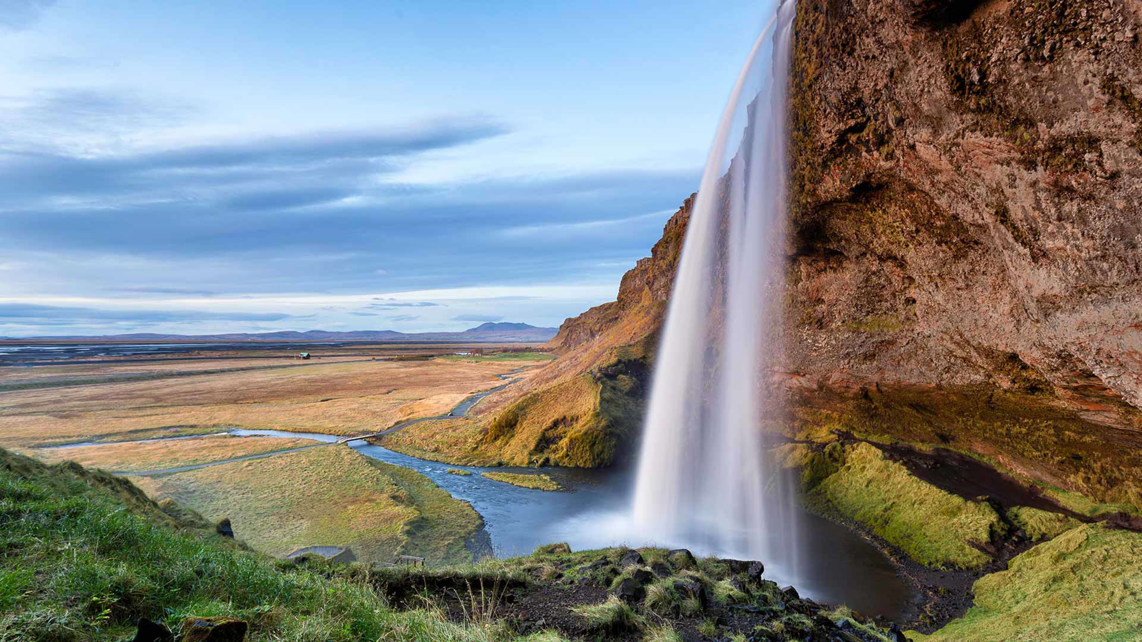
Dettifoss

Feel the force of the second most powerful waterfall in Europe.

North Iceland

About Dettifoss

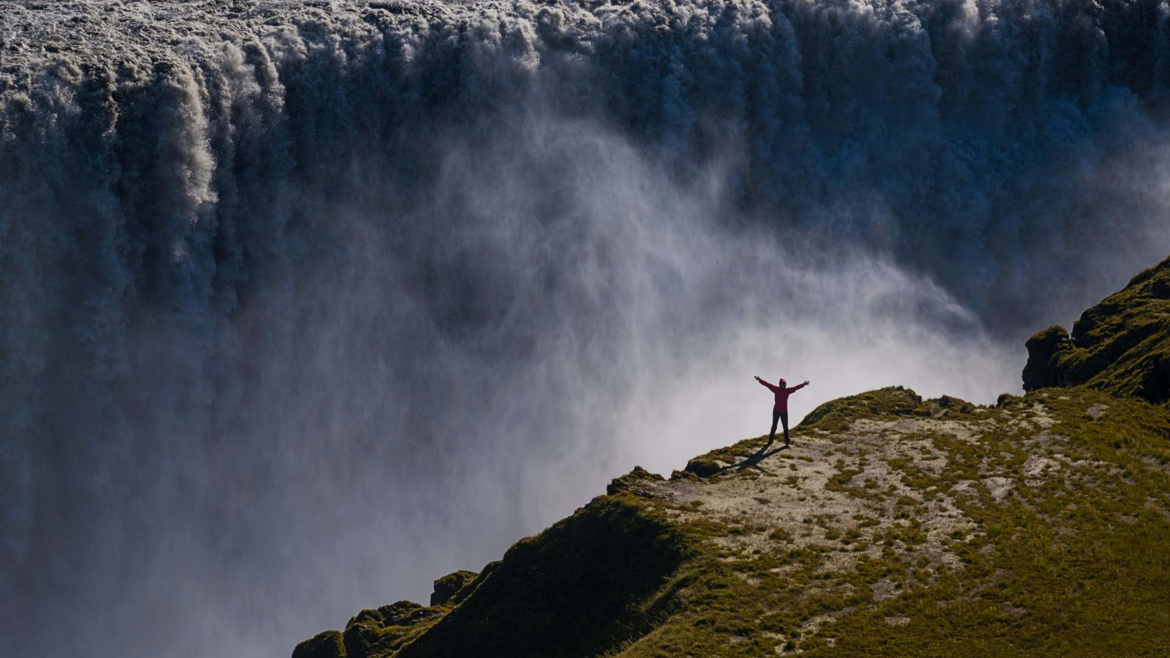
Dettifoss is a waterfall on the Jökulsá á Fjöllum river in northeast Iceland, within Vatnajökull National Park. It drops 44 metres over a width of around 100 metres, with a water flow of 193 cubic metres per second -- making it the second most powerful waterfall in Europe by volume. The river is fed by meltwater from Vatnajökull glacier, about 110 km to the south, and carries a heavy load of glacial sediment that gives the water its grey-brown colour.

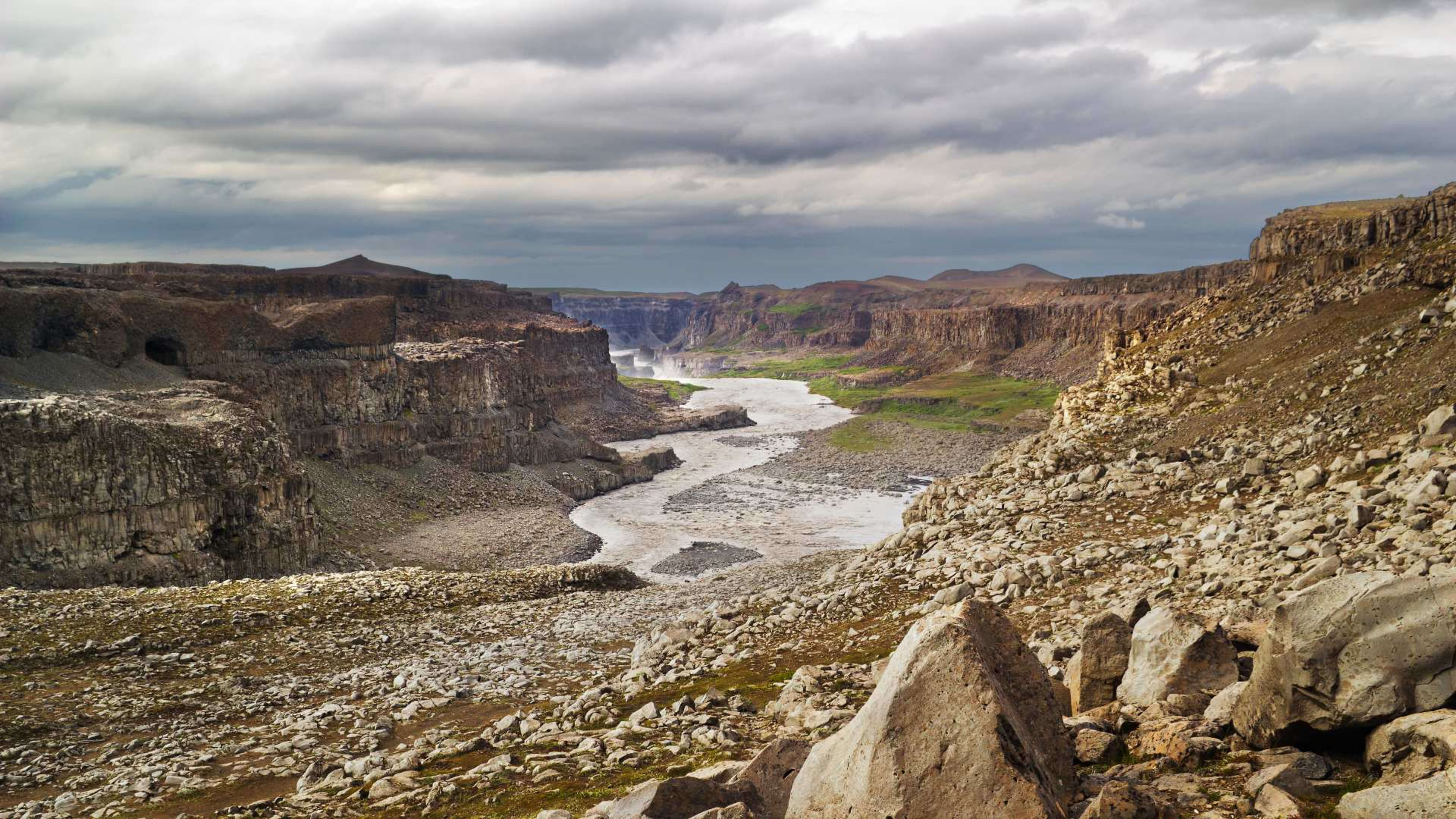
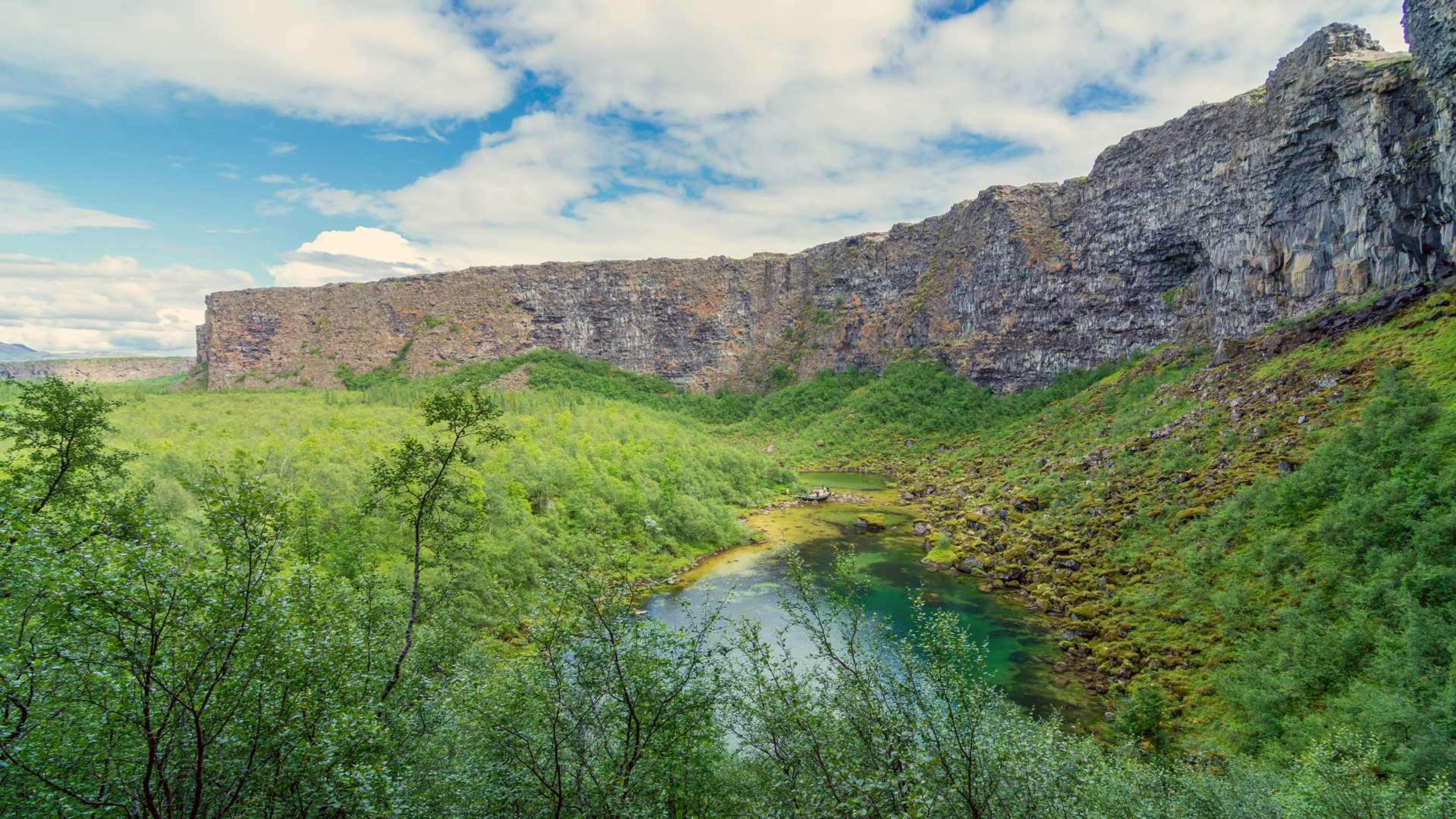
The waterfall sits in the Jökulsárgljúfur canyon, a dramatic gorge carved by glacial floods over thousands of years. The force and scale of Dettifoss make it unlike most waterfalls in Iceland -- where many are notable for their height or elegance, Dettifoss is notable for sheer volume and noise. The roar carries well before you reach the edge.

East side or west side

Dettifoss is accessible from both banks of the river, and the two approaches give different experiences.

The west side via Route 862 is on a paved road open year-round. It has more parking, a viewing platform, and several walking trails. This is the easier and more reliably accessible option in all seasons.

The east side via Route 864 is a seasonal gravel road, generally accessible in summer but often closed in winter. From the east bank you can also reach Selfoss, a broader multi-tiered waterfall about 1 km upstream, and Hafragilsfoss downstream. The east side road connects to several other waterfalls in the canyon system -- Réttarfoss, Urriðafossar, and Hólmárfossar -- making it worth the rougher drive if conditions allow.

Both sides are about 1.5 hours east of Akureyri via Route 1.

What to see nearby

A short walk upstream from Dettifoss brings you to Selfoss, which is 11 metres high and around 70 metres wide -- lower than Dettifoss but spread across a broad series of rocky ledges. The contrast between the two is worth the 20-minute walk.

Dettifoss is part of the Diamond Circle route in north Iceland, which also takes in Lake Mývatn, Ásbyrgi canyon, and the whale watching town of Húsavík. Most visitors combine Dettifoss with at least one or two of these on a multi-day north Iceland itinerary.

Getting there

From Reykjavík, Dettifoss is about 6 hours via the Ring Road -- it is best visited as part of a Ring Road self-drive rather than a day trip from the capital. From Akureyri it is around 1.5 hours. The west side road (Route 862) is the more reliable year-round route. Check road conditions on road.is before travelling, particularly for Route 864 outside of summer.

Other attractions near Dettifoss

The rocky Jökulsárgljúfur canyon

Jökulsárgljúfur

Marvel at one of the deepest canyons in Iceland.

20 km (12 mi)

View
Trees in the lush Ásbyrgi canyon

Ásbyrgi

Venture to this odd-shaped canyon on the Diamond Circle route and discover its mythological connections.

30 km (19 mi)

View
Lake Mývatn in its autumn colors

Lake Mývatn

Explore otherworldly lava formations and get close to wildlife near this lush lake.

56 km (35 mi)

View
The harbor in the fishing village of Húsavík

Húsavík

Get up close to gentle giants on a boat tour from Iceland’s whale watching capital.

88 km (55 mi)

View

FAQs about Dettifoss

Dettifoss is one of the most distinctive natural sites in Iceland. The scale and noise of the falls are unlike most waterfalls in the country -- the roar carries well before you reach the edge, and the volume of grey-brown glacial water dropping 44 metres makes an immediate impression. It is a reasonable distance from the main tourist routes, so it tends to attract visitors who have made a deliberate choice to include north Iceland in their itinerary.

Dettifoss is in northeast Iceland within Vatnajökull National Park, on the Jökulsá á Fjöllum river. It sits around 1.5 hours east of Akureyri via Route 1, and about 6 hours from Reykjavík. The river is fed by meltwater from Vatnajökull glacier roughly 110 km to the south. Just north of Dettifoss, accessible from the east bank via Road 864, are several other waterfalls in the canyon system: Hafragilsfoss, Réttarfoss, Urriðafossar, and Hólmárfossar.

You can get to the west side of Dettifoss via road 862, a paved road that’s open year-round. It connects to the Ring Road (Route 1) in the south.

The east side of Dettifoss is reachable by road 864, which is a seasonal gravel road. Road conditions mean that this route is often closed in wintertime.

Both routes are just over 1½ hour’s drive east from the town of Akureyri in North Iceland.

The west bank via Route 862 is the more practical option for most visitors. The road is paved and open year-round, with more parking, a viewing platform, and several walking trails. The east bank via Route 864 is a seasonal gravel road, generally accessible in summer but often closed in winter. From the east side you can more easily reach Selfoss upstream and the other waterfalls further along the canyon, which makes it worth considering if you are visiting in summer and have time to extend the visit.

Dettifoss has a water flow of around 193 cubic metres per second and drops 44 metres, making it the second most powerful waterfall in Europe by volume. The river carries a heavy load of glacial sediment from Vatnajökull, which gives the water its grey-brown colour and adds to the visual force of the falls.

#icelandmyway

See what travelers like you have been up to lately on Instagram.